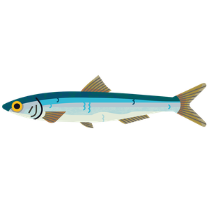
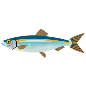
Sprat
Sprattus sprattus
What to check for
Location
Location
Location refers to two things:
- Where the fish population or stock lives, e.g., North Sea, or South Pacific.
- Who is managing the fishery. If it says “All areas”, this means that our scoring for management covers the same area as the fish stock.
West of Scotland, Celtic Seas (South): All areas
Technical location
Technical location
A global system is used to split the ocean into different zones, areas, and subdivisions. Each zone is indicated by a number and/or letter. By law, this must be shown on all unprocessed seafood sold in the EU and UK, alongside the fishing method used to catch it. Look for these details on the packet to match your seafood to our ratings.
7f: Bristol Channel, 7g: Celtic Sea (North), 7h: Celtic Sea (South), 7a: Irish Sea, 7c: Porcupine Bank, 6: Rockall, West of Scotland, 7j: Southwest of Ireland (East), 7k: Southwest of Ireland (West), 7b: West of Ireland
Caught by
Caught by
Net (pelagic trawl)
Pelagic trawling involves towing a net through mid-water or at the surface, usually without touching the seabed. It can be towed by one boat or a pair of boats. Shoals of fish are targeted using equipment such as sonar.
Net (pelagic trawl)
Rating summary
Sprat in the Celtic Seas is data limited. There is concern for the level of fishing pressure but no concern for biomass. There are few appropriate management measures in place for sprat in the Celtic Sea. Although catch advice is provided for the stock, this has continually been exceeded since its implementation in 2013. The fishery benefits from a well-developed Monitoring, Control and Surveillance (MCS) system, with effective enforcement and low levels of illegal, unreported and unregulated (IUU) fishing. All recent sprat landings have been taken by pelagic trawls, which have negligible benthic impacts. There is overlap with zero-catch herring in the Irish Sea. Bycatch of ETP species is minimal. Due to the importance of sprat as a prey species for fish, seabirds, and cetaceans, it is possible that the fishery has the potential to impact the trophic webs in the region.
Rating last updated July 2026
How we worked out this Rating
Please note this rating uses our new methodology.
Stock status
The size and health of a fish population, or 'stock', that is being targeted by fishermen is a crucial indicator of whether a fishery is sustainable. If the stock is too small to withstand fishing, it is at risk of crashing. We look at how big the stock is, and how much pressure there is from fishing, to assess this. The target level that many fisheries aim for is 'Maximum Sustainable Yield' - the most fish that can be caught year after year whilst keeping the population at a healthy size.
Stock Status Score: 0.75
Sprat in the Celtic Seas is data limited. There is concern for the level of fishing pressure and but no concern for biomass.
Stock assessments for sprat in this area are conducted every two years by the International Council for the Exploration of the Sea (ICES). The most recent assessment, published in 2025, used data up to 2024. Stock structure remains uncertain, and it is not known whether sprat should be assessed as a single unit or multiple units.
As there are no reference points for fishing pressure or biomass, Route 2 scoring has been applied. Sprat has medium resilience to fishing pressure. As a short‑lived species, it naturally exhibits large interannual fluctuations in biomass. However, there is currently no assessment of biomass against reference points.
Acoustic surveys are carried out in several areas, but it is unclear which populations they represent. The Celtic Sea Herring Acoustic Survey (CSHAS) is timed for herring, and sprat catches are incidental. Sprat abundance in the Celtic Seas often peaks after the survey period, as such, survey trends may underestimate true biomass.
Survey results show mixed patterns. Sprat biomass in the 2020 survey was the lowest in a decade, followed by an increase to 2022, then a decline in 2023 back to 2021 levels. The Agri‑Food and Biosciences Institute (AFBI) survey in Northern Ireland recorded a decline from 2016 to a 15‑year low in 2022, followed by a doubling in 2023. Despite substantial data limitations and some conflicting trends, the increase in 2023 and the fact that survey biomass typically exceeds average catches by several orders of magnitude indicate no current concern for biomass.
Since 2013, catch advice has followed the precautionary approach, with a 20% reduction every three years. ICES advises that catches in 2026 and 2027 should not exceed 1,792 tonnes annually - a 20% decrease from the 2022–2025 advice of 2,240 tonnes. Despite this, catches have exceeded advice every year since 2013, with an estimated 17,151 tonnes landed in 2024, more than seven times the advised limit. As a result, there is concern for fishing pressure.
ICES notes that annual variation in biomass is driven mainly by recruitment rather than fishing pressure, and survey biomass generally exceeds catches by several orders of magnitude. However, historical landings data may be inaccurate, particularly due to difficulties quantifying landings from vessels under 10m. Given uncertainties in stock structure and limited survey coverage, the potential for local depletion should continue to be monitored.
Management
Good management is vital to be sure that fishing doesn't cause fish populations to decline. We look at whether regulations follow the best available scientific advice, how well compliance is monitored and enforced, and whether this is effective in maintaining healthy fish stocks.
Management of the Target Stock Score: 0.75
Alignment with Scientific Advice Score: 1
Monitoring, Control and Surveillance Score: 0.25
There are few appropriate management measures in place for sprat in the Celtic Sea. Although catch advice is provided for the stock, this has continually been exceeded since its implementation in 2013. The fishery benefits from a well-developed Monitoring, Control and Surveillance (MCS) system, with effective enforcement and low levels of illegal, unreported and unregulated (IUU) fishing.
Sprat fisheries in the Celtic Seas and West of Scotland are sporadic, taking place in different locations at different times. The stock structure remains poorly understood, and it is not known whether sprat should be managed as a single stock unit or divided into multiple assessment areas. This uncertainty limits the strength of the scientific evidence available to support management decisions and means that the stock cannot currently be assessed against conventional biomass or fishing mortality reference points.
Management of the sprat fishery remains limited. Unlike other commercial fish stocks in the region, sprat is not subject to a jointly agreed TAC, or minimum landing size. Instead, management across the region relies largely on technical measures, and broader management measures for multiple species. Most sprat are caught in small-mesh fisheries, with a small proportion to human consumption, but majority to fishmeal and oil. Under technical gear regulations, the minimum mesh size for targeting sprat is 16 mm.
Some measures have recently been introduced in Irish waters. From October 2025, vessels over 18 metres targeting sprat within the 6 nautical mile zone require authorisation and are subject to catch restrictions (2,000 tonnes). From October 2026, Ireland will prohibit trawling by vessels over 18 metres within the inshore 6 nautical mile limit. These measures are expected to provide protection for important sprat habitats and aggregations.
Sprat can generally be targeted with relatively low levels of bycatch. However, in the Irish Sea there is substantial overlap with herring, creating a risk of bycatch of juvenile herring. This is of particular concern because both Irish Sea herring stocks are in poor condition. The northern Irish Sea stock is currently fished above FMSY and Fpa, with spawning biomass below MSY Btrigger and Bpa, while the southern stock has fallen below Blim and is subject to zero-catch advice. When zero-catch advice for the southern stock was first issued in 2020, sprat catches initially declined, but subsequently increased again. In addition, the zero-catch advice for herring was not followed, with non-zero TACs continuing to be set and catches continuing to occur. The continuing overlap between sprat and herring fisheries in the Irish Sea therefore remains an important management consideration.
ICES provides precautionary catch advice for sprat, but catches have exceeded this advice in every year since precautionary limits were introduced in 2013. Since 2021, only Ireland and Scotland have reported sprat landings, with Ireland accounting for the majority of catches. Discarding is estimated to be less than 1% of the catch, although this estimate is based on limited and uncertain sampling. Although fluctuations in sprat biomass are driven largely by recruitment variability, appropriate and responsive management of the target stock remains important.
Monitoring, control and surveillance of UK fisheries are delivered through licensing, vessel tracking, statutory reporting, observer coverage, inspections and other monitoring systems. All commercial fishing vessels must hold a valid UK fishing licence to operate in UK waters, although exemptions may apply to some unpowered vessels under 10 metres. Depending on the area, target species and activity, additional permits or authorisations may also be required.
Vessel tracking requirements vary by vessel size, area and administration through Vessel Monitoring Systems (VMS) and, where applicable, inshore VMS (iVMS).
• Vessels 12 m and over must report their position every two hours via VMS.
• Vessels under 12 m report their position continuously where iVMS applies, or may operate full VMS where required by licence conditions or when fishing offshore.
Reporting of fishing activity, catches, landings, discards and port movements is mandatory, with logbooks supporting traceability:
• Vessels 12 m and over submit electronic logbooks under Council Regulation 1224/2009.
• Vessels 10–12 m (and under 10 m Producer Organisation vessels) use paper logbooks, updated daily and submitted within 48 hours of landing.
• Non-PO vessels under 10 m are generally exempt unless required by licence conditions.
UK vessels must also carry fishery observers when directed, providing independent verification of activity and catch. Remote Electronic Monitoring (REM), using cameras, sensors and positional data, is being increasingly deployed to improve data quality and support enforcement. Its rollout is supported by the Fisheries Act 2020 and the Joint Fisheries Statement. In Scotland, REM has been mandatory for scallop dredge vessels since June 2024 and pelagic vessels since March 2026.
Together, these measures help prevent illegal, unreported and unregulated (IUU) fishing through vessel licensing, catch documentation, positional monitoring, statutory reporting and compliance checks. Enforcement action may include financial penalties, prosecution, licence suspension or other sanctions. The UK has committed to reducing IUU fishing and maintains a blacklist of vessels involved in such activities. This rating reflects full compliance with UK monitoring, control and surveillance requirements.
Similar monitoring, control and surveillance requirements apply to EU vessels under the EU Fisheries Control Regulation, including vessel tracking, electronic catch reporting, landing declarations, inspections and traceability requirements. The revised Regulation entered into force in January 2024 and introduces a phased requirement for REM with onboard cameras on EU vessels over 18 m identified as high risk for Landing Obligation non-compliance, alongside wider increases in digital reporting and traceability. Implementation and enforcement are undertaken by individual Member States, so observer coverage, inspection activity, enforcement effort and REM deployment can vary between countries and fisheries.
The Marine Conservation Society views Remote Electronic Monitoring (REM) with cameras as one of the most cost-effective tools for providing reliable fisheries data and aiding informed management decisions. Fully monitored fisheries enhance collaboration, data accuracy, stock recovery, and reduce impacts on marine wildlife and habitats. However, the full potential of REM may only be achieved when it tracks fishing location and documents catch and bycatch, particularly where vulnerable species and habitats are at risk.
The Fisheries Act (2020) requires the development of Fisheries Management Plans (FMPs) (replacing EU Multi-Annual Plans) in the UK. 43 FMPs have been proposed and are at various stages of development and implementation, these should all be published by the end of 2028. FMPs have the potential to be very important tools for managing UK fisheries, although data limitations may delay them for some stocks. It is also essential the UK governments define and adopt a standardised approach or model across the four nations to a universally defined FMP design, to ensure the consistence, quality and coherence of all the proposal FMPs.
The Marine Conservation Society is keen to see publicly available Fishery Management Plans for all commercially exploited stocks, especially where stocks are depleted, that include:
- An overview of the fishery including current stock status, spatial coverage, current fishing methods and impacts
- Targets for fishing pressure and biomass, and additional management when those targets are not being met, based on the best scientific evidence
- Timeframes for stock recovery
- Improved data collection, transparency, and accountability, supported by technologies such as Remote Electronic Monitoring (REM)
- Consideration of wider environmental impacts of the fishery, including habitat impacts and minimising bycatch
Stakeholder engagement
Capture method
Environmental impacts of fishing vary hugely, depending on the method used and where it's happening. We look at whether the fishing gear being used could have an effect on seabed habitats, and if so, how severe might this be. We also review whether it catches any other species by accident (bycatch), and what effect this might have on those species - especially if they're Endangered, Threatened, or Protected.
Capture Method Score: 0.5
Habitat Impacts: 0
Bycatch Impacts: 0.5
Vulnerable and ETP Species: 0.25
Ecosystems and Trophic Webs: 0.5
All recent sprat landings have been taken by pelagic trawls, which operate in the water column and therefore have negligible benthic impacts. However, due to overlap with herring stocks in parts of the fishery, particularly in the Irish Sea, sprat fishing has the potential to result in incidental catches of herring, including stocks that are currently subject to zero-catch advice. Bycatch of Endangered, Threatened, or Protected (ETP) species is considered minimal. Due to the importance of sprat as a prey species for fish, seabirds, and cetaceans, it is possible that the fishery has the potential to impact the trophic webs in the region.
In 2024, all sprat landings were taken using pelagic (midwater) trawls, with the majority originating from Ireland (16,857 tonnes) and a smaller proportion from Scotland (294 tonnes). Pelagic trawls are towed within the water column and do not make contact with the seabed. Trawl doors hold the net open, allowing fishers to capture entire shoals, often consisting of a single species. As these gears operate off the seafloor, they are associated with no seabed contact.
Sprat may be taken as bycatch in fisheries targeting herring, but they can also be targeted directly on an opportunistic basis when dense sprat aggregations form. As herring has become a more tightly restricted fishery, the limited availability of herring quota increasingly shapes both the timing and the scale of sprat fishing activity. The herring stock north of 52°30’N in the Irish Sea is currently overfished, with concerns regarding both biomass and fishing pressure, while the stock south of this boundary is depleted and subject to zero-catch advice. Even under a zero-catch scenario, the spawning stock biomass of the southern Irish Sea herring stock is projected to continue declining over the next two years. Although sprat fisheries can generally be prosecuted with relatively low levels of bycatch, there is substantial spatial overlap between sprat and herring in the Irish Sea. Consequently, any incidental catches of herring within targeted sprat fisheries can hinder stock recovery and add to the decline of an already depleted stock.
Bycatch of Endangered, Threatened, or Protected (ETP) species can occur in pelagic trawl fisheries. Cetaceans are particularly at risk because they feed on the same fish shoals targeted by pelagic trawlers, leading to incidental captures of species such as common dolphins. Acoustic deterrent devices (‘pingers’) may be fitted to reduce cetacean interactions, but their overall effectiveness remains uncertain. For sprat fisheries, incidental capture of non-fish species is low.
The ecosystem impacts of the sprat fishery primarily relate to the removal of a key forage species rather than from the fishing method itself. Pelagic trawls generally have minimal seabed impacts, and targeted sprat fisheries are typically relatively selective. Sprat occupy an important low-trophic position in the Celtic Seas food web, acting as both predator and prey for a wide range of species. They are an important food source for commercial fish, seabirds, and marine mammals, and changes in their abundance can have disproportionate effects on ecosystem structure and function. The Celtic Seas region is also an important feeding area for several baleen whale species, which rely heavily on small pelagic fish such as sprat and herring during the autumn and winter months.
The role of sprat within the food web may become increasingly important as other forage species, particularly herring, decline in the Irish Sea region. As alternative prey become less available, predators may become more reliant on sprat. Despite this, the species' wider ecological role remains poorly understood and removals are not regulated through a dedicated management framework. Although there is currently no indication that sprat biomass is depleted, fishing pressure increased sharply in 2024 and catches have consistently exceeded precautionary ICES advice. Continued high levels of exploitation could reduce sprat availability as prey and contribute to broader changes in food-web dynamics and ecosystem functioning within the Celtic Seas.
References
Froese, R., Pauly, D. 2026. FishBase. Sprat, Sprattus sprattus. Available at: Sprattus sprattus, European sprat : fisheries, bait [Accessed on 20.07.2026].
Gov.ie. 2025. Press Release: Minister Dooley gives legal effect to restrictions on trawling by larger vessels inside the six nautical mile zone as announced with Minister Heydon in July. Available at: Minister Dooley gives legal effect to restrictions on trawling by larger vessels inside the six nautical mile zone as announced with Minister Heydon in July [Accessed on 20.07.2026]
ICES. 2026. Herring Assessment Working Group for the Area South of 62° North (HAWG). ICES Scientific Reports. VOL 8:16. 892 pp. https://doi.org/10.17895/ices.pub.31424315.
ICES. 2026. Herring (Clupea harengus) in Division 7.a North of 52°30’N (Irish Sea). In Report of the ICES Advisory Committee, 2026. ICES Advice 2026, her.27.nirs. https://doi.org/10.17895/ices.advice.32133760
ICES. 2026. Herring (Clupea harengus) in divisions 7.a South of 52°30’N, 7.g–h, and 7.j–k (Irish Sea, Celtic Sea, and southwest of Ireland). In Report of the ICES Advisory Committee, 2026. ICES Advice 2026, her.27.irls. https://doi.org/10.17895/ices.advice.32133742
ICES. 2025. Sprat (Sprattus sprattus) in Subarea 6 and divisions 7.a-c and 7.f-k (West of Scotland, southern Celtic Seas). In Report of the ICES Advisory Committee, 2025. ICES Advice 2025, spr.27.67a-cf-k. https://doi.org/10.17895/ices.advice.27202899
ICES. 2025. Working Group on Acoustic and Egg Surveys for small pelagic fish in Northeast Atlantic (WGACEGG; outputs from 2024 meeting). ICES Scientific Reports. 7:56. 218 pp. https://doi.org/10.17895/ices.pub.29070443
ICES. 2025. Bycatch of endangered, threatened and protected (ETP) species of marine mammals, seabirds, marine turtles and selected fish species of bycatch relevance. In Report of the ICES Advisory Committee, 2025. ICES Advice 2025, byc.eu. https://doi.org/10.17895/ices.advice.30734714
ICES. 2025 Celtic Seas Ecosystem – fisheries Overview. In Report of the ICES Advisory Committee, 2025. ICES Advice 2025, section 7.2. https://doi.org/10.17895/ices.advice.30710879
ICES. 2024. Celtic Seas Ecoregion – Ecosystem overview. In Report of the ICES Advisory Committee, 2024. ICES Advice 2024, Section 7.1, https://doi.org/10.17895/ices.advice.25713033
Seafish. Unknown. Pelagic Trawl. Available at: Pelagic Trawl | Seafish [Accessed on 20.07.2026]
Sustainable swaps
Learn more about how we calculate our sustainability ratings.
How our ratings work
Add impact to your inbox
Join the movement: get updates on the issues you care about.
We'll email you inspiring stories about the work we're doing to save and recover our oceans, and news about our urgent campaigns for positive change.